.png)
Motivation
In the next three years, three pairs of primary schools and five pairs of secondary schools will be merging, the MOE said in a press release on April 6 (Abdullah, 2022).
The announcement of these mergers brought about mixed reactions amongst students and educators of the schools. For instance, amongst the mergers, one pair of schools that will be merging is Pioneer Primary and Juying Primary in 2022 (Ang, 2021). The principal of Pioneer Primary Lee Wai Ling once said she felt "sad" at first after receiving news that the school would be merged. Additionally, many parents as well as their children who were affected by the closure of their school were also concerned about the increased inconvenience as it would mean that their children would have to travel even further to access the merged school.
On the other hand, others had positive reactions towards the mergers where principal of Stamford Primary Cassie Fan believed that the students will have greater access to a wider range of educational programmes and CCAs, thus enriching their experience in schools.
"Declining birth rates and changing demographics in our housing estates have led to falling enrollment in several of our schools. At the same time, some areas are experiencing rising demand for school places", said Ms Liew Wei Li, Ministry of Education's director of schools and deputy-director general of education (Liew, 2021).
With Ms Liew's statement in mind, we wanted to investigate how accessibility has changed after the past few mergers and closures. Through our project, we also wanted to take this opportunity to analyse the accessibility of schools from residential areas using QGIS software and Network Accessibility Analysis.
Project Objectives
The objective of this project is to analyse the impact of school mergers and closures on the accessibility to education in different institutional levels. Our analysis will cover the following institutional levels:
Primary Schools
Secondary Schools
Junior College
The time period we chose to analyse where school closures and mergers happened is between January 2018 to April 2021 and we intend to compare the changes in accessibility of the different educational levels using choropleth maps before and after school mergers and closures.
Tasks
The project tasks are as follows:
Accessibility of the three educational levels before school closures and mergers in April 2021
Accessibility of the three educational levels after school closures and mergers in April 2021
Compare the accessibility maps by creating choropleth maps for the three educational levels before and after school closures and mergers
Population density maps of populations aged:
Primary school students: 7 to 12 years old
Secondary school students: 13 to 17 years old
Junior college school students: 17 to 20 years old
Data
For this project, the following data sources are recommended but students are welcome to include other appropriate data.
Roads data from OpenStreetMap (OSM) data sets. The data from Geofrabrik site is recommended instead of bbike as quality of the data provided by Geofabrik is better than bbike.
Education data. This dataset provides general information of public primary schools, secondary schools and junior colleges. It was downloaded from data.gov.sg and geocoded by using SLA OneMap Api.
Population data from Singstat Singapore. This dataset provides the ages and number of people living in each subzone within planning areas in 2021.
Master Plan 2014 Subzone Boundary from URA. This data can be downloaded from data.gov.sg.
Scope of work
The scope of the project will include the following steps:
Selection of project area (i.e. time period to use)
Data collection, extraction, integration, transformation and wrangling
Designing and building GIS model and database
Preparing report
Performing network accessibility analysis
Performing population analysis by creating choropleth maps
Preparing poster and project website
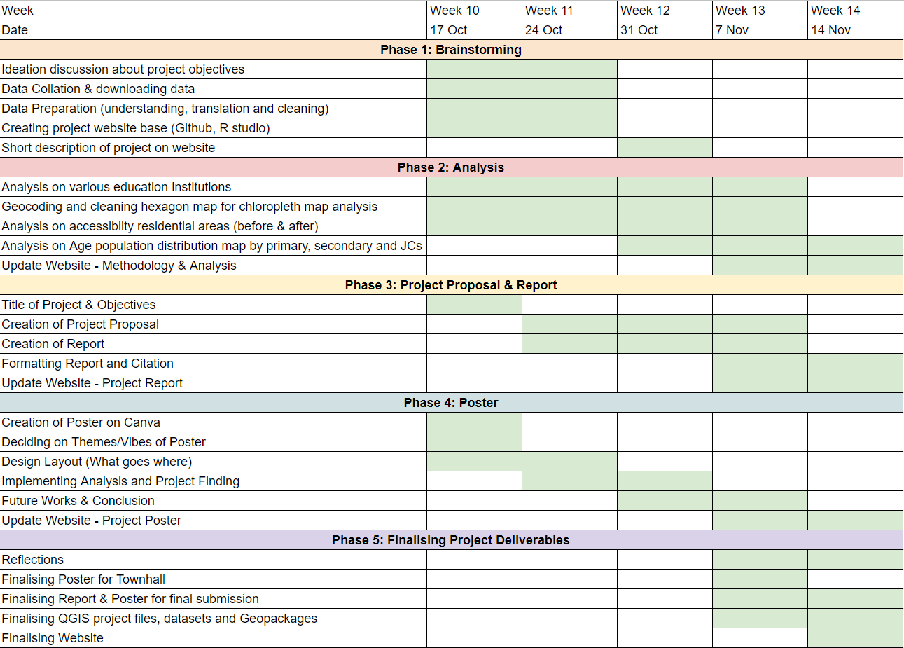
Project timeline
This is our group’s project timeline in the form of a Gantt chart.